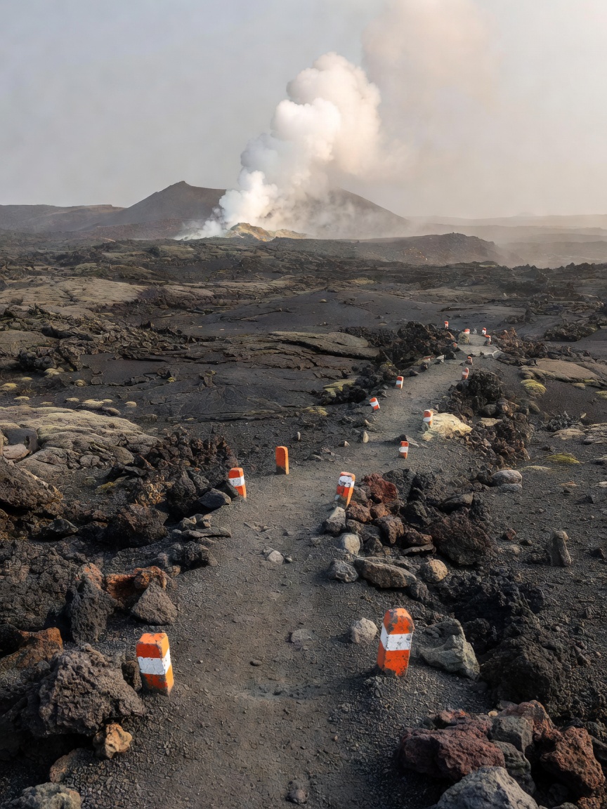
A geological trail is not defined by a label on a map. It is a way of moving through evidence: a change in rock, a cut bank, a spring line, a ridge that frames a basin. The best field reading starts slowly. Notice the path underfoot, the slope it follows and the landforms visible from safe, designated viewpoints.
Read the route before the rock
Before setting out, understand the walk as it exists now. Check the current map and land manager’s information for closures, distance, elevation, surface, services, transport, weather exposure and any seasonal restrictions. A trail described online may be altered, rerouted or closed. Volcanic regions can also have additional warnings for gas, heat, unstable ground, eruptions, snow or rockfall.
Use official maps and signs as the source for navigation. A geological interpretation guide is not a substitute for route-finding, emergency preparation or current hazard notices. Carry water and clothing suitable to the forecast, tell someone your plan when appropriate, and choose a route that fits your experience and the day’s conditions. Never cross a barrier because a visible landmark seems close.
At the trailhead, look for the relationship between land and infrastructure. Does the path follow a ridge to avoid wet ground? Does a boardwalk cross delicate mineral crust? Does a switchback reduce erosion on a steep slope? These practical choices can also tell a story about the landscape. They show how people can move through sensitive terrain with less impact.
Build an observation sequence
Choose one feature and describe it without interpreting it: “a dark, rough surface with small rounded holes,” or “a pale band crossing the lower slope.” Then ask what process might produce it. Could the holes be vesicles in lava? Could the band be a mineral deposit, a sediment layer or a vegetation boundary? Compare the idea with official interpretation and surrounding evidence. Good field notes keep observation and explanation distinct.
Look for relationships rather than isolated curiosities. A vent may sit along a fracture. A stream may cut through layers that were once horizontal. A slope may show a lava flow edge above older ground. A terrace may form where heated water spills and cools. The way features connect often says more than their appearance in a single close-up.
Use the path as a moving cross-section. On a climb, notice whether vegetation thins, rock changes or wind exposure increases. On a descent, watch how water channels and deposits accumulate. Take a short note at each transition. The trail’s sequence can reveal changes in elevation, substrate, moisture or the age of exposed material.
A good walk leaves room for a second look: at the slope, the line of the trail, and the evidence the first glance missed.
Landscapes that invite careful walking
Yellowstone’s boardwalk networks guide visitors through geyser basins and hot-spring areas, where a route is essential protection around thin crust and hot water. The paths at Iceland’s Haukadalur geothermal area make it possible to observe Strokkur and nearby features while keeping visitors on established ground. Current closures and route arrangements belong to the park or site manager, not to a static description.
At Þingvellir National Park, a walk through fissures and rift-related scenery connects tectonic structure with a landscape that also has deep cultural significance. On Hawaiʻi’s Big Island, trails in Hawaiʻi Volcanoes National Park offer views of lava fields, crater terrain and changing ecosystems; access can be revised in response to volcanic activity and other hazards. These are places where maps, ranger guidance and current notices deserve attention before every visit.
In Italy, trails on Mount Etna pass through varied elevations, volcanic deposits and vegetation zones. Weather can shift between lower slopes and summit areas, while access and permitted routes depend on conditions and local rules. Around Mount Vesuvius, managed visitor routes and views across the Bay of Naples put an active geological setting beside a dense human landscape. Respect the official route and never treat a volcano’s quiet appearance as a condition report.
The Giant’s Causeway in Northern Ireland and the basalt scenery of Scotland’s Staffa demonstrate how a short coastal walk can reveal cooling fractures and columnar forms. Yet cliffs, waves and changing weather are as important to route choice as geology. At Pamukkale, paths and visitor rules protect fragile travertine. In each case, the right way to interpret the land depends on the rules that preserve it.
Let the trail carry several timescales
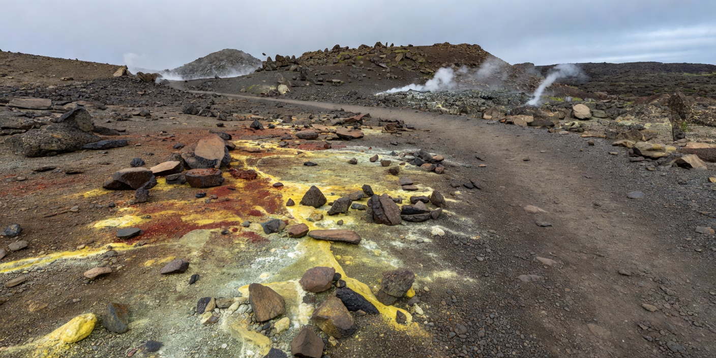
A single walk may cross deposits formed in an instant and surfaces shaped over thousands of years. An eruption can lay down ash or lava quickly; cooling, cracking and weathering follow. Water erodes material, plants colonise soil, and people make paths across the resulting terrain. These timescales overlap, which is why a clear landscape story rarely fits into one dramatic event.
At Devils Tower in Wyoming, columnar rock stands above surrounding terrain as erosion exposes an igneous body. At the Giant’s Causeway, basalt columns show cooling and contraction, with the sea and weather continually working the coast. At Santorini, caldera form and island topography offer a broad view of volcanic history, while inhabited places and visitor routes reflect present-day life. A field journal can hold both scales: a note about a visible fracture and a question about the much longer process that exposed it.
Photograph without leaving the path
Use the trail’s designated viewpoints and keep people, wildlife and fragile formations out of the frame rather than stepping around a barrier. A telephoto image, a sketch or a change in perspective from the official path is often enough. Do not place equipment over hot ground or unstable edges. Follow local rules for drones, tripods, flash and commercial photography.
Record where and when you made the observation, but avoid publishing sensitive locations if doing so could increase pressure on an unprotected feature. Images can flatten scale and make hazardous places look approachable. Captions should explain that access depends on current local rules and not suggest that a path or feature remains open indefinitely.
Access is a present-tense fact
Geology is comparatively durable; access is not. A volcanic landform may remain recognizable while its trail closes due to a storm, eruption, maintenance, wildfire, conservation work or changed transport. Check official information close to departure and again on site. Follow staff instructions even when older maps show a different route. Emergency notices and local authorities take precedence over this general field guide.
Once on the path, leave rocks, plants and mineral deposits in place. Keep to the surface designed for visitors, pack out litter and avoid disturbing wildlife. Respect the cultural significance of landscapes and the people who care for them. A geological walk is an encounter, not a claim of ownership.
Carry a small field method
Before the walk, read the route notice. During it, pause at transitions and note shapes, textures, sounds and water movement. Separate what you saw from what you think it means. Afterwards, compare your notes with reliable park interpretation or geological sources. That sequence—prepare, observe, question, verify—makes a modest trail more rewarding than a rush toward a famous viewpoint.