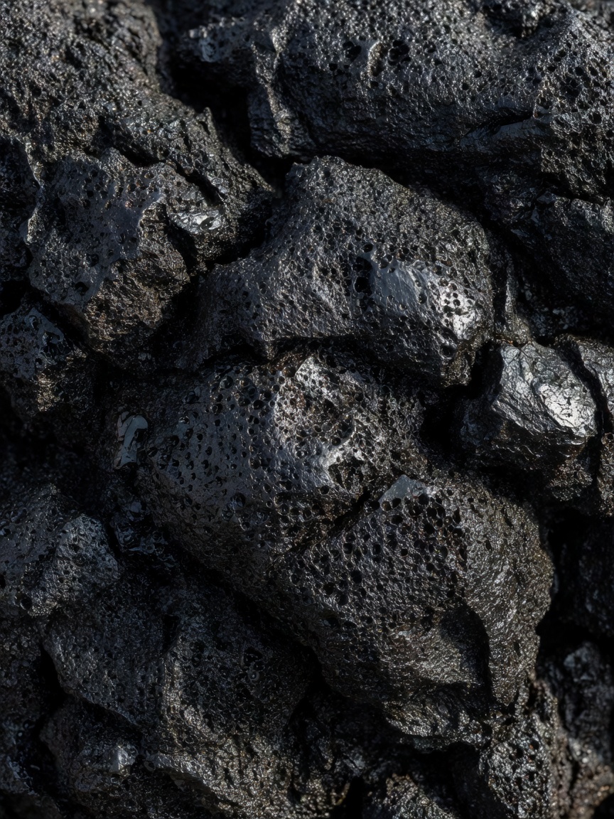
Volcanic rock invites a tactile response: knobbly, sharp-edged, smooth as glass or full of holes. The safe way to investigate is with your eyes. A lava field may contain fragile crusts, unstable blocks and protected features, while a cliff edge can hide a long drop. At a marked viewpoint, texture becomes evidence without becoming a surface to climb.
Start with shape and texture
Lava is molten rock that reaches Earth’s surface. As it cools, its viscosity, gas content, slope and rate of movement influence the resulting form. In Hawaiʻi, pahoehoe lava can form smooth, folded or rope-like surfaces; ʻaʻā generally cools into rough, clinkery blocks. These words describe textures, not a guarantee of how easy the ground is to cross. Even an old flow can be sharp and hazardous.
Basaltic lava is commonly dark and relatively low in silica compared with many more viscous lavas. Rhyolite has higher silica content and can be associated with thick lava domes and explosive eruptions. The relationship between composition and eruption style is not a simple one-variable rule: dissolved gases, magma supply and the surrounding system matter too. A field guide should make room for complexity rather than turn a rock colour into a prediction.
Small holes in lava are vesicles, spaces left by gas bubbles as molten rock cooled. A glassy surface suggests rapid cooling, while mineral crystals record slower cooling or earlier growth in magma. These observations help describe a rock, but a precise identification may require a geologist’s close examination, context and testing.
Cones, craters and calderas
A volcanic cone may form as material accumulates around an eruptive vent. Cinder cones are often modest in scale, built from loose fragments; stratovolcanoes develop through repeated layers of lava and fragmental deposits. A crater is a depression around a vent, while a caldera is a much larger collapse feature that can form when a magma reservoir is partly emptied and its roof subsides. The rim of a caldera may be broad, broken and altered by later activity.
Vesuvius, overlooking the Bay of Naples, is a stratovolcano whose summit area and visitor access are managed. Its appearance should not be confused with a live status report: current volcanic information and route conditions must come from official authorities. Santorini’s caldera, in Greece, marks a major volcanic history expressed in steep island edges and a flooded central basin. Those dramatic vistas are shaped by both geological events and ongoing erosion.
At Hawaiʻi Volcanoes National Park, Kīlauea’s changing summit and rift landscapes show how an active volcanic system can reshape familiar viewpoints. Crater forms, lava fields, steam and ground conditions can change, and access restrictions are made for safety and protection. The park’s trails and interpretive guidance provide a more reliable way to understand what can be visited on a given day than a dated photograph or old travel account.
A lava field is not simply frozen fire. It is a surface still being rewritten by rain, plants, gravity and time.
Layers that tell a longer story
Look for contrasts. A dark flow may lie against pale ash or older weathered soil. A cliff can reveal stacked deposits: lava, ash, pumice or reworked volcanic material. On Mount Etna in Sicily, repeated eruptions have produced a varied volcanic landscape, from summit terrain to extensive flank flows. Eruption products and access differ across the mountain, and seasonal weather can change rapidly with elevation.
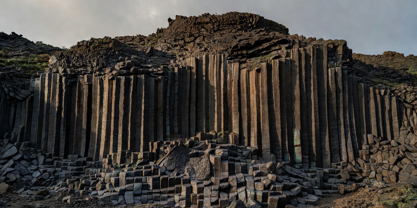
Iceland’s Þingvellir National Park offers a very different kind of geological reading. Its rift-related landscape is associated with the separation of tectonic plates, visible through fissures and fault-bounded ground. It is not a conventional lava-cone viewpoint; its value lies in the way landscape, tectonics and cultural history meet. At the Giant’s Causeway in Northern Ireland, columnar basalt formed as lava cooled and contracted. The regular geometry can seem designed, but it is a physical consequence of cooling and fracture.
Devils Tower in Wyoming is an igneous intrusion exposed through erosion, a striking example of how rock that cooled below the surface can later stand above its surroundings as softer material wears away. Theories about its exact shape and emplacement have a geological history of their own; visitors should distinguish accepted broad explanations from simplified claims. The columned cliffs at Fingal’s Cave on the island of Staffa, Scotland, also show cooling fractures in basalt, though access and sea conditions influence how they can be experienced.
Walk the edge without crossing it
Volcanic ground is often less stable than it appears. A thin lava crust can conceal voids; loose cinders shift underfoot; weathered rock may crumble at a cliff edge. Steam and gases can collect in low places or emerge from cracks, and active volcanic zones may have hazards not visible from the path. Use designated routes, follow warning systems and never enter a closed area for a better photograph.
Before visiting, check the park or land manager’s current notices, maps, hours, transport details and any alert information from the relevant geological or civil-protection authority. Do not rely on a fixed list of open trails: routes may close because of eruption, wildfire, rockfall, snow, maintenance or ecological protection. Conditions can differ sharply between lower slopes and high summit paths.
Bring water, sun protection and layers appropriate to the elevation and season. Follow local rules for drones, pets and collecting. Rock samples should remain where they formed unless collecting is explicitly allowed; in national parks and protected sites, removal is commonly prohibited. A photograph, sketch and a note about the rock’s location preserve the observation without taking the evidence away.
What the eye can and cannot tell
You can describe a slope, a flow edge, a pattern of fractures or a contrast in deposits. You can compare those observations with interpretive signs and authoritative park material. But a landform alone rarely tells a visitor when it last erupted, whether it is currently active or what hazards are present today. Those are questions for current monitoring and local authorities.
Let the sequence guide your attention: what was deposited, what cooled, what fractured, and what erosion has exposed? Notice where vegetation begins to reclaim the ground and where water channels through the rock. Volcanic landscapes are not finished monuments. They are processes caught, briefly, in a view.