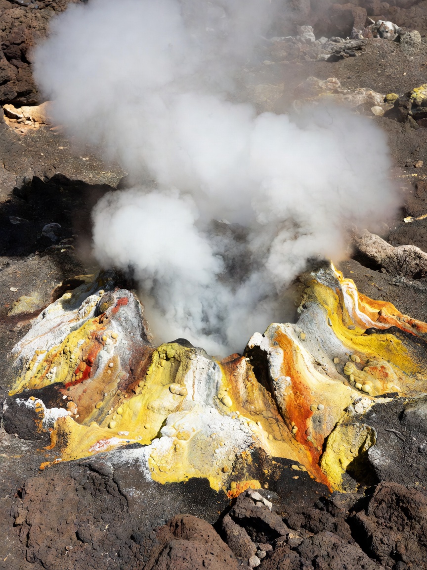
The first clue is often atmospheric: a whiff of sulphur, a haze on a cold morning, or a patch of ground bare of frost. The process beneath it is less visible. Groundwater moves down through pores and fractures, takes heat from hot rock, and rises buoyantly. Along the way it can dissolve minerals and gases. At the surface, the result may be a steaming vent, a boiling pool, a bubbling mud pot or merely warm ground.
Sort the vents by what they release
A fumarole is a vent through which steam and volcanic gases escape. Its output and chemistry vary: some vents release mostly water vapour, while others carry gases such as carbon dioxide or hydrogen sulphide. The scent of rotten eggs can be associated with hydrogen sulphide, but smell is not a safe measure of concentration. Never approach a vent to identify it by scent, and heed official warnings and closures.
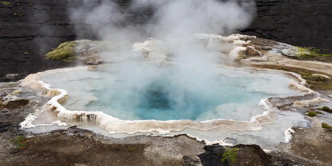
A hot spring is a place where heated groundwater reaches the surface as liquid. A geyser is a special case: pressure builds in a constricted underground plumbing system until water and steam erupt. Yellowstone’s Old Faithful is a famous example, but its intervals are observations, not a guarantee of an exact showtime. Mud pots form where acidic water and steam alter surrounding rock into fine clay; bubbling mud is not simply a spring with a different colour.
These distinctions matter because the appearance of a feature does not explain its temperature, chemistry or stability. A quiet pool can be scalding. A dry-looking crust can cover hot water. Steam can conceal edges and make depth difficult to judge. Stay behind barriers and on maintained boardwalks even when another viewpoint seems close.
Steam is a moving boundary: water below, air above, and a brief visible trace of the heat between them.
Read the deposits, carefully
White, pale-grey terraces are often associated with silica sinter deposited as hot water cools and loses dissolved silica. Mammoth Hot Springs in Yellowstone is well known for travertine terraces, where calcium carbonate builds changing forms. At Iceland’s Haukadalur geothermal area, Geysir and Strokkur sit among steaming ground and mineral-altered surfaces. Neither setting is a frozen tableau: water flow shifts, deposits grow, and access routes may be adjusted to protect both visitors and fragile ground.
Colour is useful as a prompt, not a diagnosis. Yellow material can include sulphur; orange and rust colours may indicate iron-bearing minerals; vivid greens and blues in pools can relate to water depth, dissolved materials, light and microbial life. Without sampling and analysis, a visitor cannot confidently identify every stain. Avoid touching, collecting or placing anything in the water. Even small disturbances can harm delicate microbial mats or mineral surfaces.
Look instead at form. A line of deposits may mark an earlier water level. A terrace lip can show where water spilled and cooled. A patch of steaming ground can indicate many small pathways rather than one dramatic vent. Photograph details with a scale that does not require you to leave the trail; a boot is not a suitable measuring tool on unstable or protected ground.
Landscapes to compare
Yellowstone National Park in the United States has geyser basins, hot springs, fumaroles and mud pots. Its Upper Geyser Basin concentrates several kinds of feature along established walking routes. In Iceland, Haukadalur’s Strokkur is a frequently erupting geyser, while the wider island’s geothermal landscapes include Námafjall near Lake Mývatn and the steaming ground around Krafla. Each site has a distinct setting and visitor system; do not assume access rules transfer from one to another.
New Zealand’s Rotorua region presents geothermal activity within a living town and wider cultural landscape. Whakarewarewa, Wai-O-Tapu and Te Puia are managed visitor settings with their own paths, services and protocols. At Japan’s Beppu, thermal waters are strongly associated with local bathing culture, but the visible “hells” or jigoku are viewing attractions rather than bathing pools. In Italy, the Phlegraean Fields west of Naples remind visitors that geothermal activity can occur near densely inhabited places and is monitored as part of a broader volcanic system.
Other destinations include El Tatio in Chile’s Andes, where high elevation and early-morning conditions shape the experience, and the geothermal areas of Kamchatka, where remoteness and conservation considerations are central. The comparison is not a checklist of places to collect. It is a chance to ask how climate, geology, water chemistry and management shape what can be seen.
Plan for a changing field
Geological processes may persist for centuries, but a particular trail, viewing platform or service can change quickly. Before departure, consult the current official site for opening information, closures, transport, weather and safety notices. Heavy rain, snow, ice, volcanic unrest, maintenance and ground movement can alter access. This journal explains features; it cannot provide live route status.
Choose footwear suited to the maintained route and conditions. Keep children close, respect barriers and avoid leaning over edges for photographs. Follow all local instructions about drones, tripods, food, pets and photography. At high-altitude sites such as El Tatio, account for elevation and cold; at busy parks, plan around visitor capacity and transport arrangements.
Most importantly, distinguish an observation from an interpretation. “Steam rises from a narrow opening” is a field observation. “This is a fumarole” is a geological interpretation that may be supported by signs and site information. “The vent is safe to approach” is not a conclusion a visitor should draw from appearance. Let the official route set the distance, and let the landscape supply the questions.
A compact field method
Pause at the designated overlook. Note weather, light and the direction steam drifts. Sketch the shape of a deposit or the spacing of vents without crossing the route boundary. Read interpretive signs and compare their language with what is visible. Ask what evidence supports each explanation and what remains uncertain. That patient method reveals more than a close-up ever could, while keeping the fragile, hot ground undisturbed.